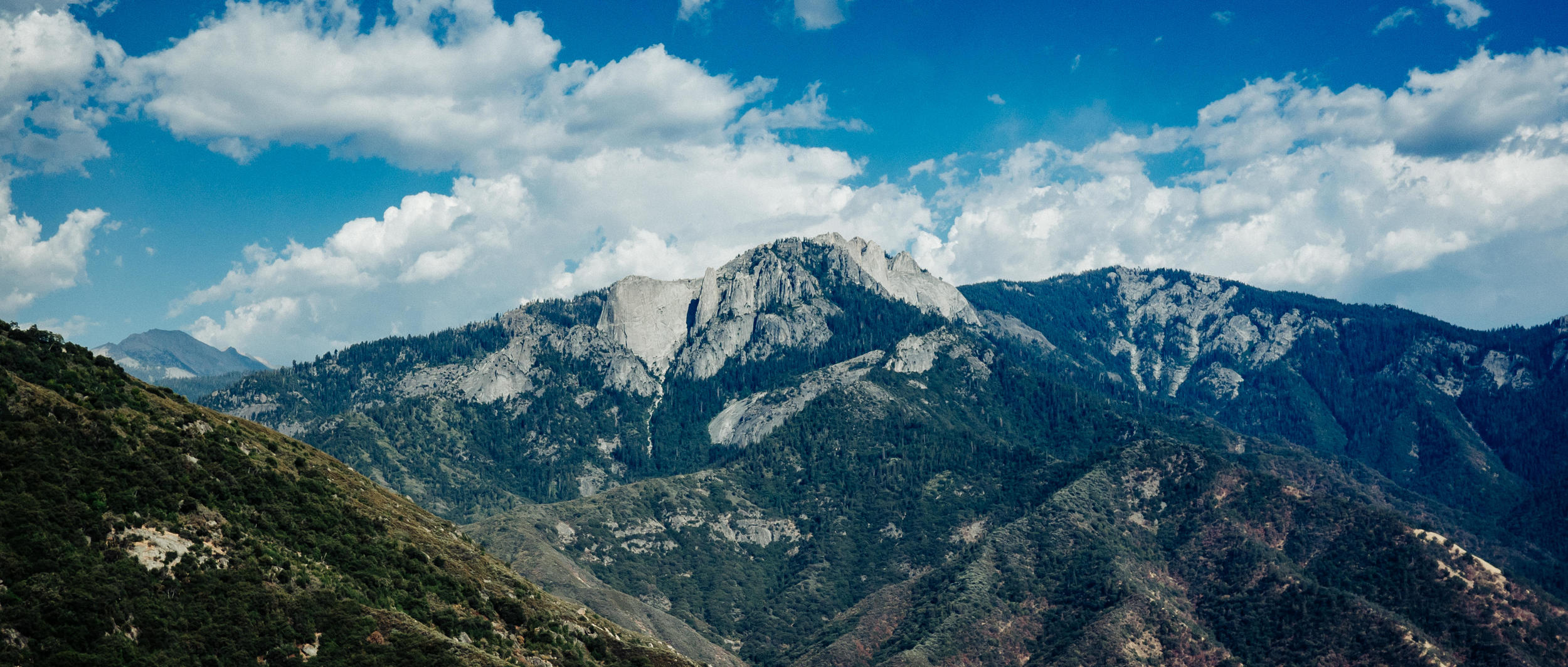
Climbing up to 6,000’ along Generals Hwy in the Sequoia National Park. Turns out the mighty giant sequoia trees, the most massive living single-stem trees on earth, only grow at higher elevations - between 5,500’ (1.67km) and 9,000’ (2.75km). Hence, even after you enter the park, it takes a while before you get to see any sequoias. But, thankfully, you get to see THIS as you climb up.
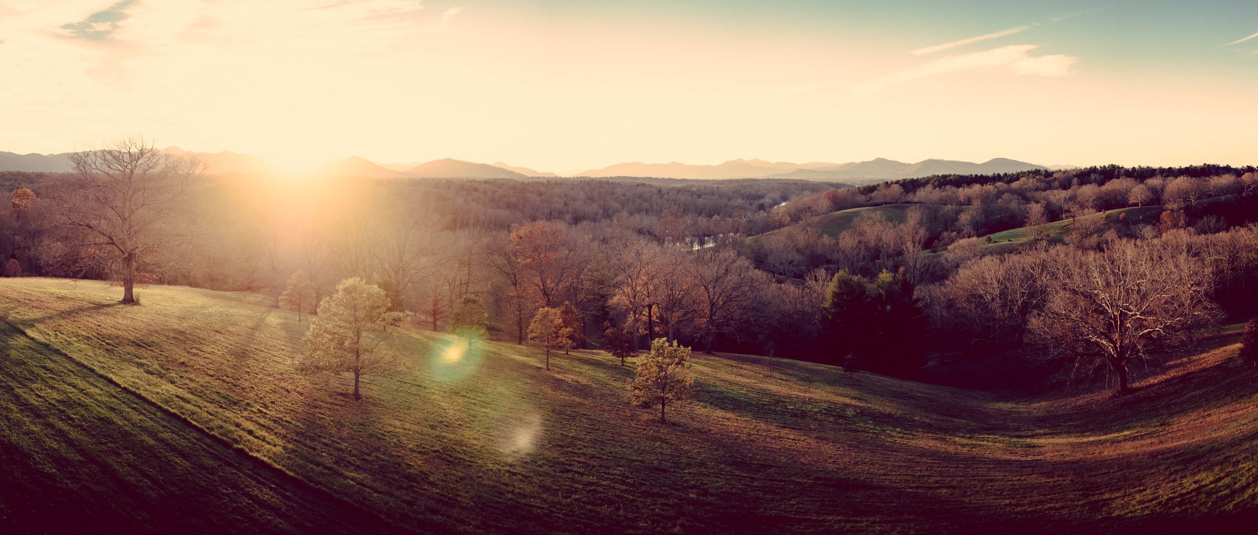
Looking at these 8,000 acres of Biltmore Estate, it’s hard to fathom that the original property extended over 125,000 acres of Appalachian forestland. George Washington Vanderbilt II bought enough land that after his death in 1914, 86,700 acres (352 km²) were sold to the federal government to create a national forest - the Pisgah National Forest. And that’s just one aspect of it. Just the Biltmore House alone is impressive - it’s the largest private residence in the United States; the architect of the House - Richard Morris Hunt - is the same person who designed the façade of the Met and the pedestal for Statue of Liberty, among many other projects (tid bit for hostel bookers: ‘Hostelling International - New York’ building on Amsterdam Ave was also Hunt’s work); Frederick Law Olmsted designed the grounds and gardens of the Estate - the same person who designed NYC’s Central Park and the Capitol grounds in Washington, D.C.; the forests around the Estate were managed by Gifford Pinchot, who went on to become the first director of the U.S. Forest Service. It took >6 years and >1000 workers to build this private estate (still a private property to this day)…which is essentially just a summer home…in which NOBODY currently resides.
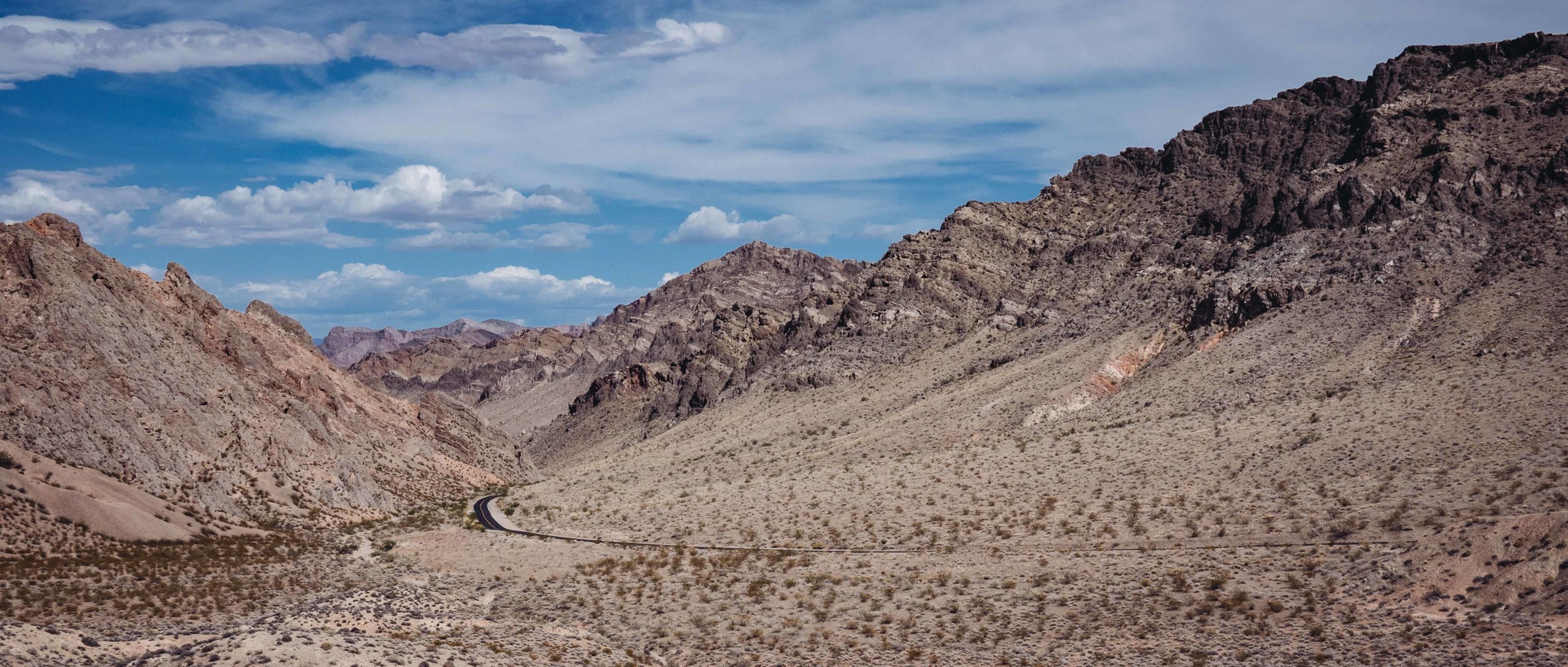
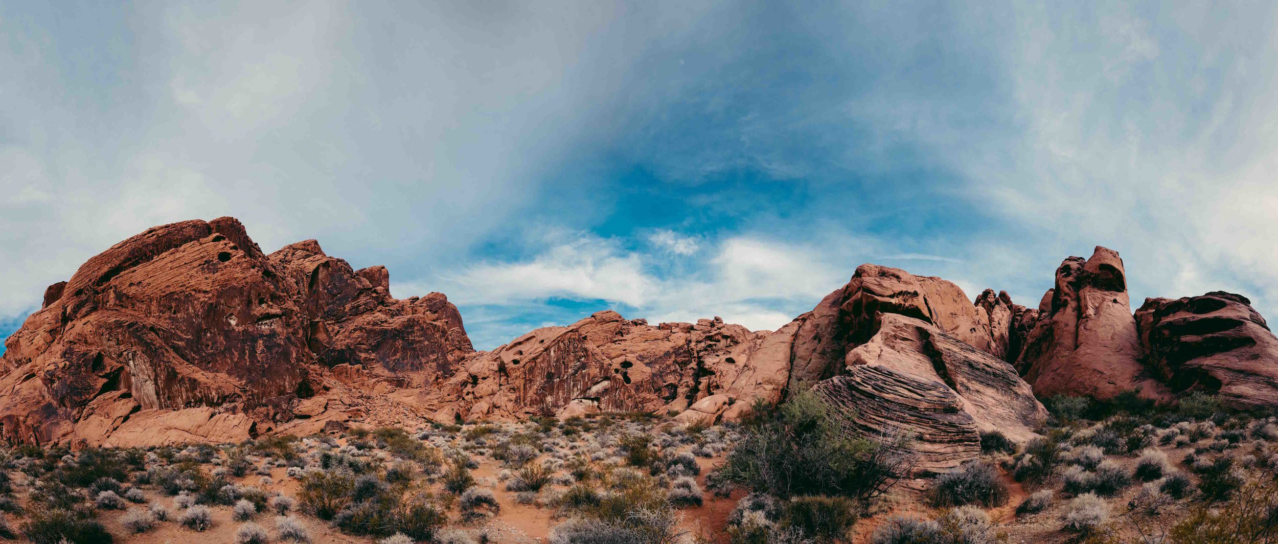
The Valley of Fire State Park, a hour outside of Las Vegas. This place looks and feels like the home of Wile E. Coyote and The Road Runner.
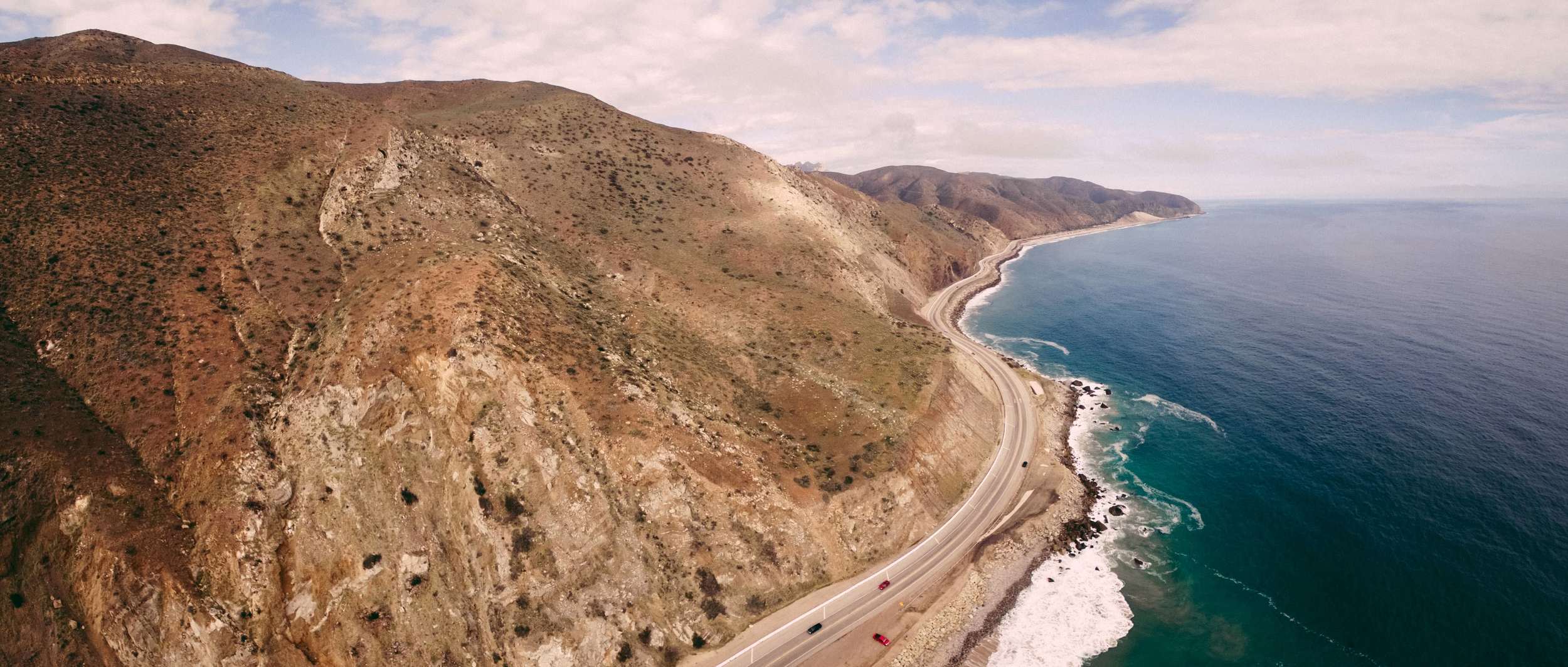
Cruisin' down Hwy 1 is a delight in and of itself.
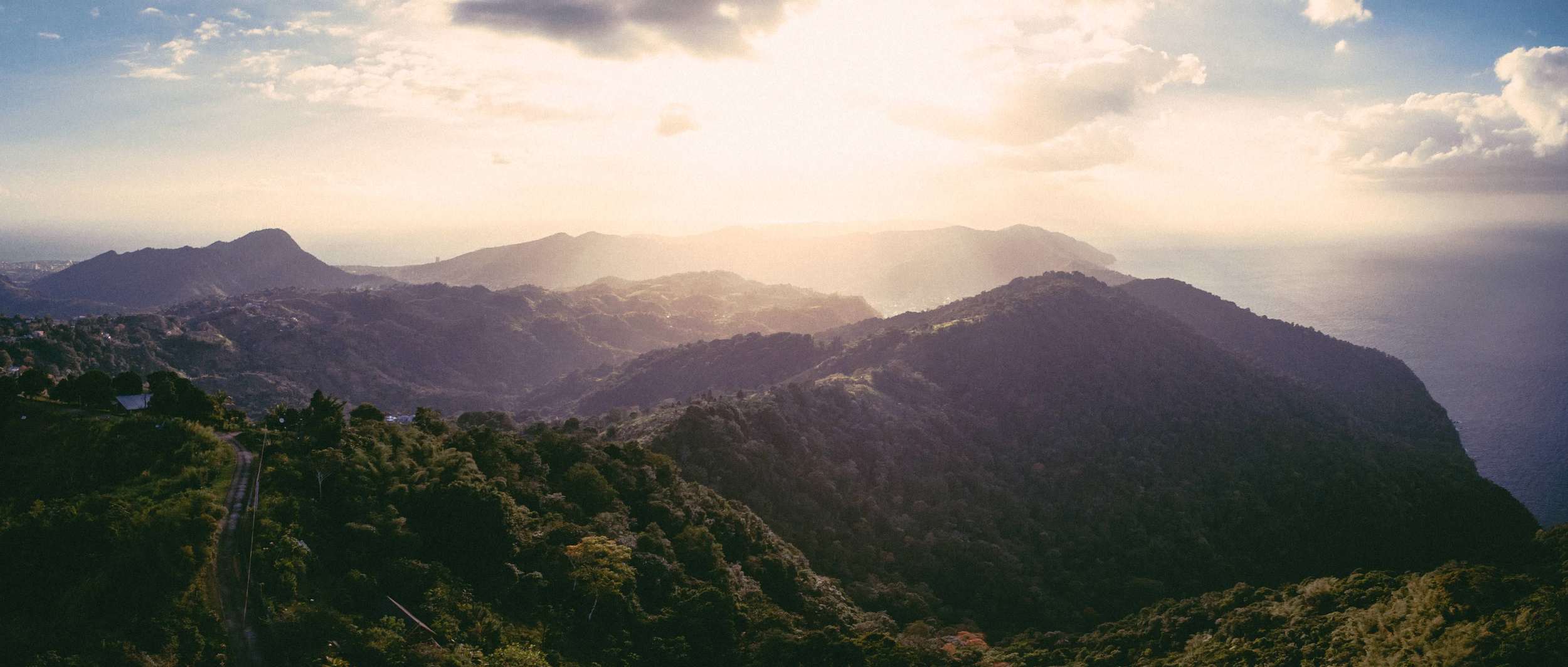
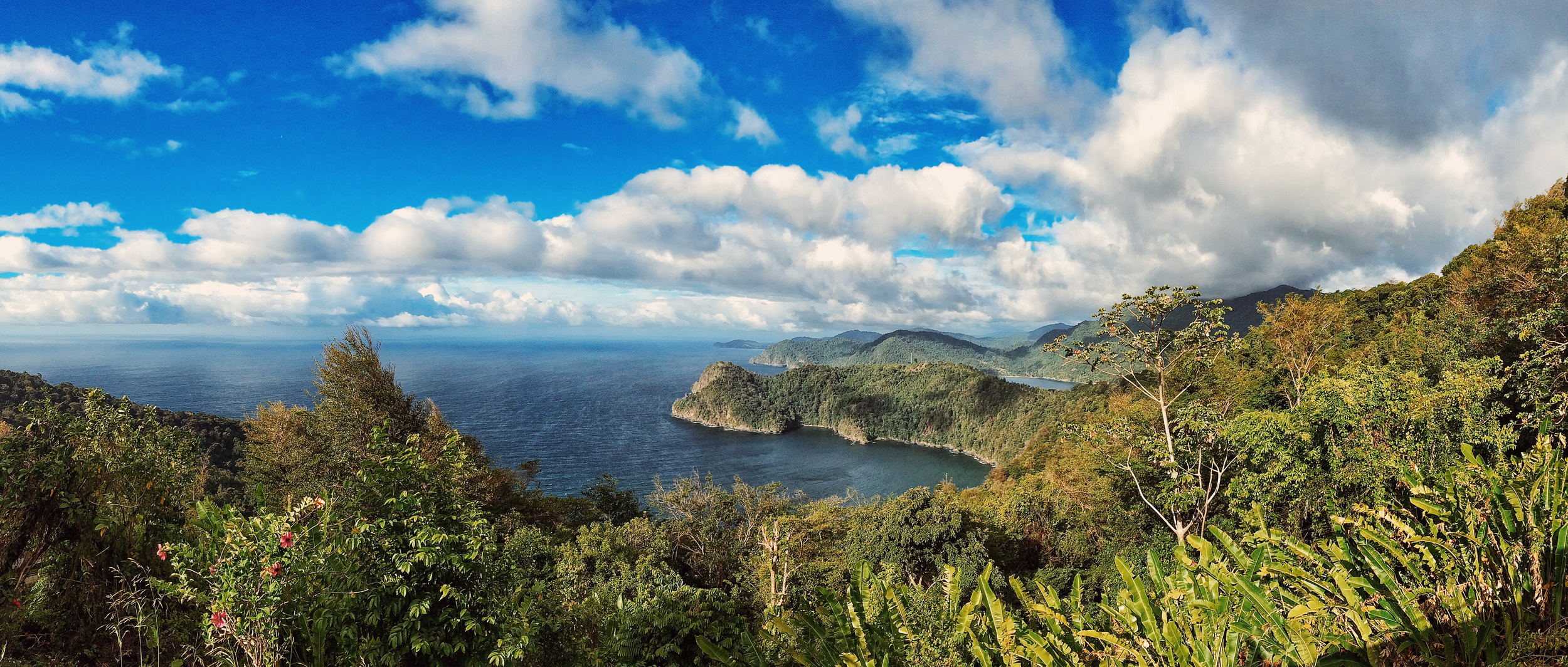
High up from the Paramin peak in Trinidad.
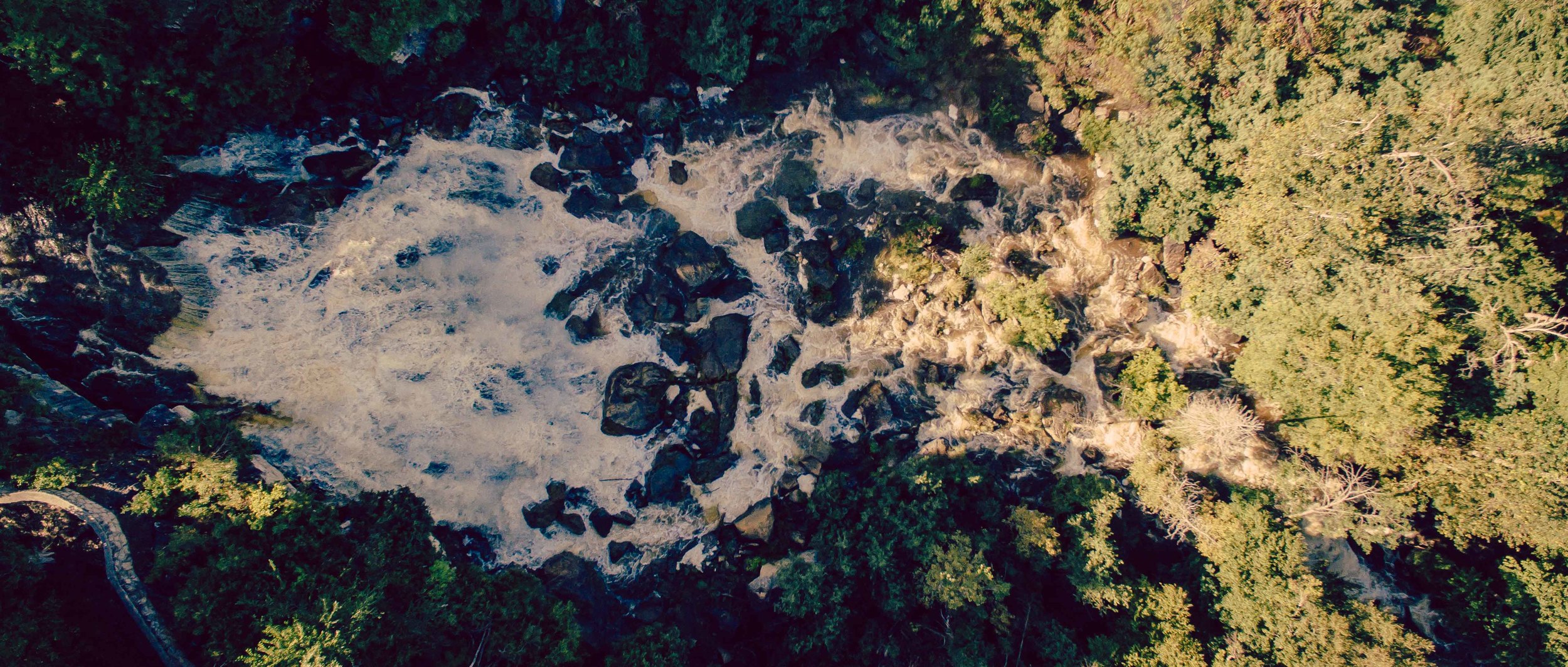
The elements doing their thing, along the Niagara Escarpment in Southern Ontario.
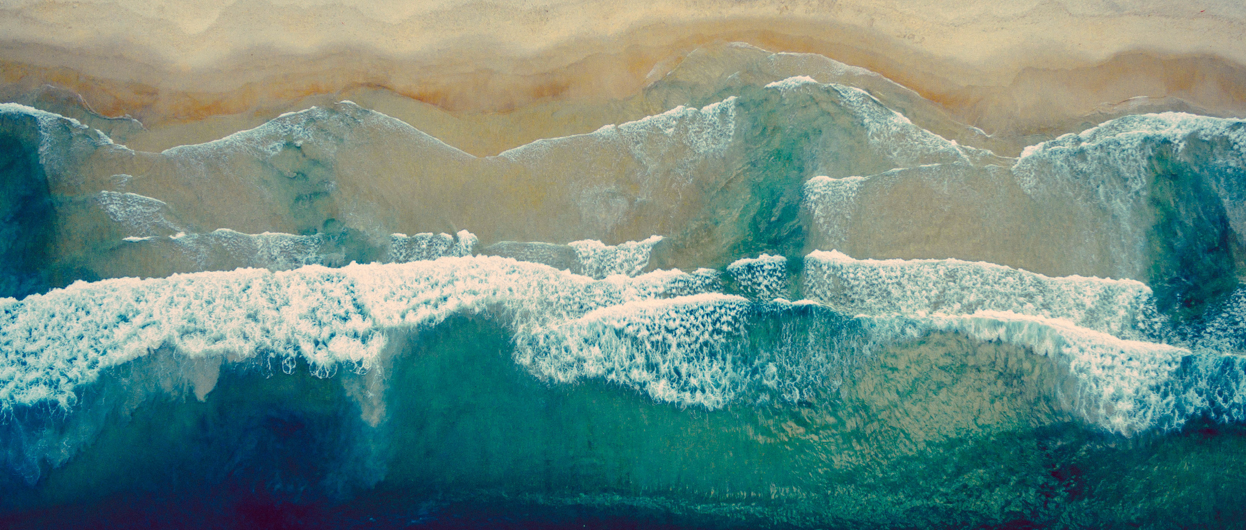
Above the beach of Maracas on the North coast of Trinidad.
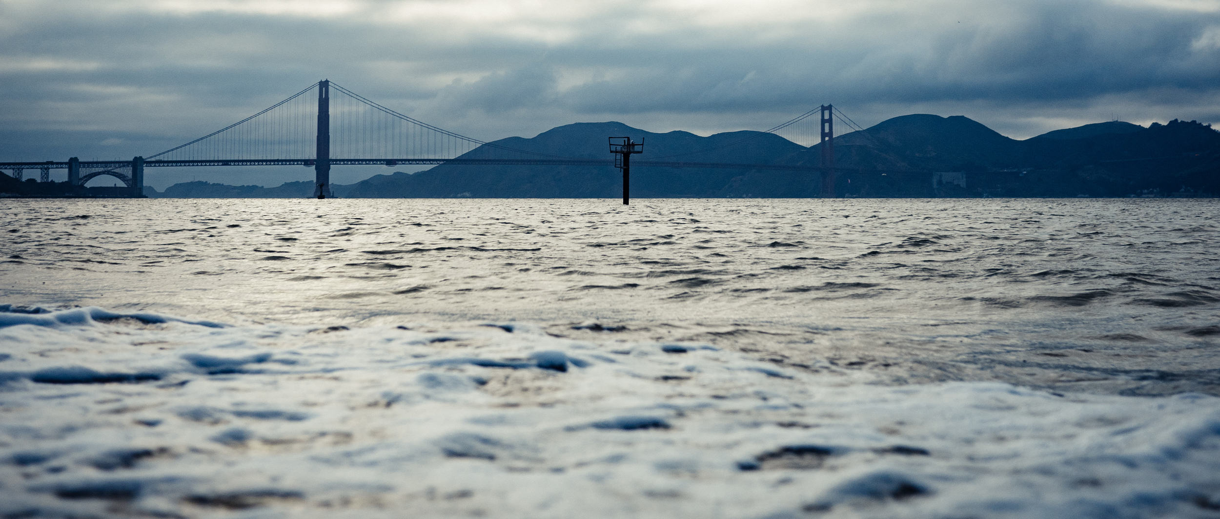
Summers in San Francisco can get really cold, which is not something you expect when packing for California.
The 150 million year old red sandstone formations of Nevada’s Valley of Fire State Park.
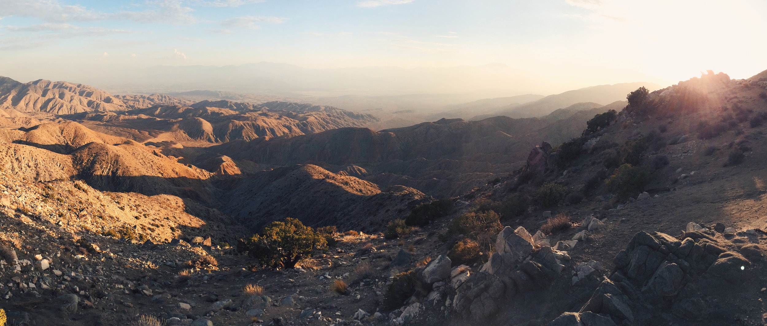
This is the Mojave Desert side of the park. The beauty of this place - that is the part you hear about before ever setting you foot in there. What you don’t expect to encounter when driving around a desert park are all the damn BEES that follow you around. The bees, in their search for water, are attracted to any moisture source, including human perspiration. So they think your face is their drinking fountain.
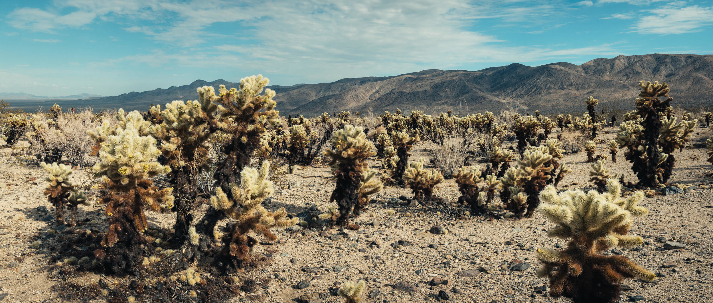
When you plan a trip to the Joshua Tree National Park you expect to see, well, Joshua trees. Once you get to the visitor centre, you learn that Joshua trees are only in the Mojave side of the park, while the Colorado Desert side has a starkly different ecosystem going on. Then when you get to visiting all the places in the park, you realize that it should really be called the BEES NATIONAL BEES DAMN SO MANY BEES PARK. These Cholla cacti are a particular favourite of the bees for creating hives, cause they provide a comparatively easy source of moisture.
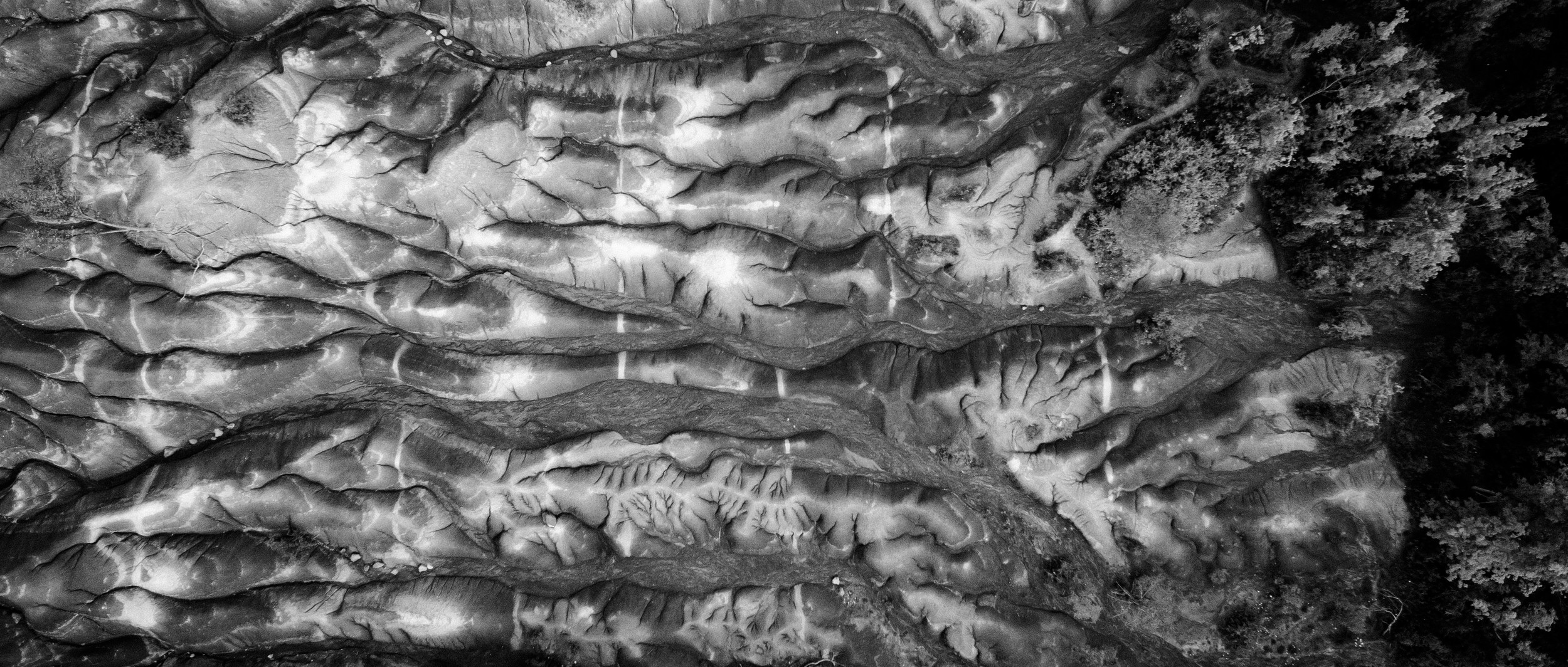
The Cheltenham Badlands feature exposed and eroded Queenston Shale, which was exposed by poor farming practices in the 1930s. The hills signify the riverbed and the colour is due to iron oxide deposits that remained after the area dried out thousands of years ago. Best part - this is mere 35 minutes away from the Toronto
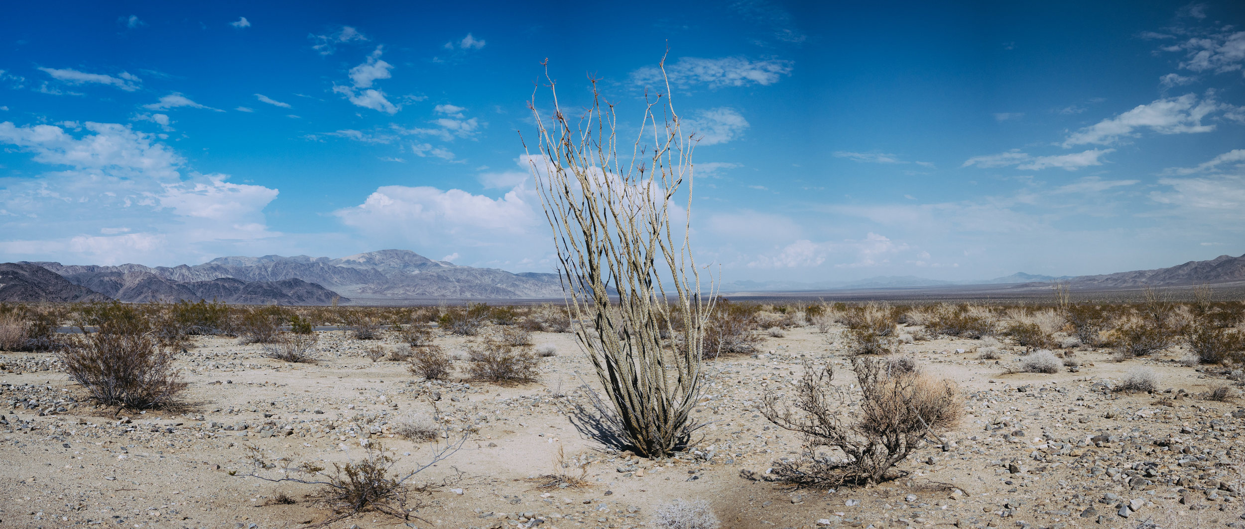
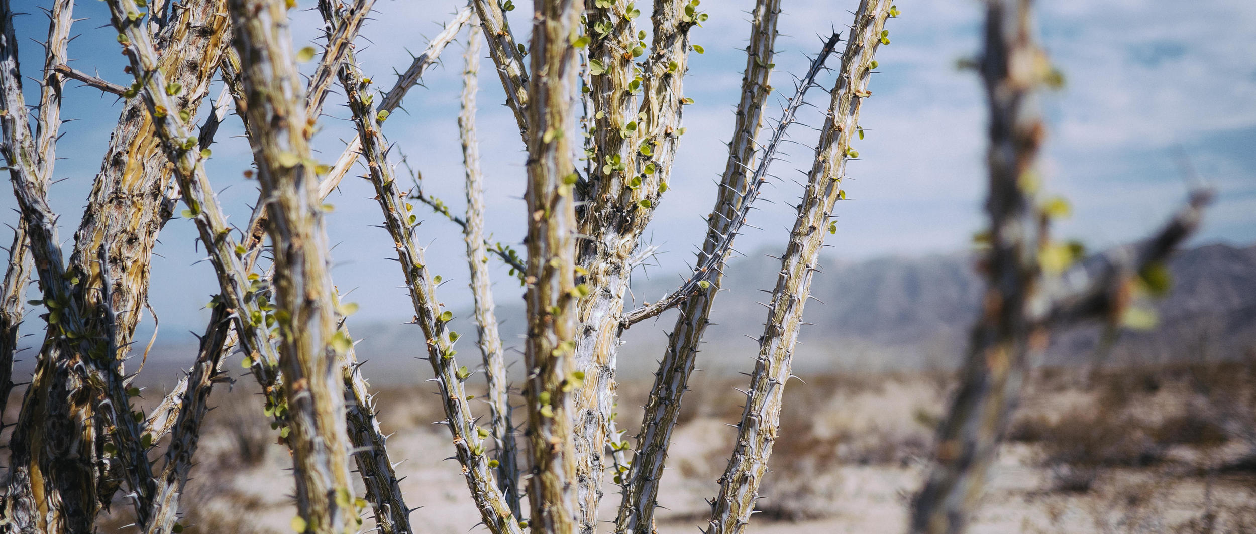
A fearless Ocotillo, refusing to surrender to the desert.
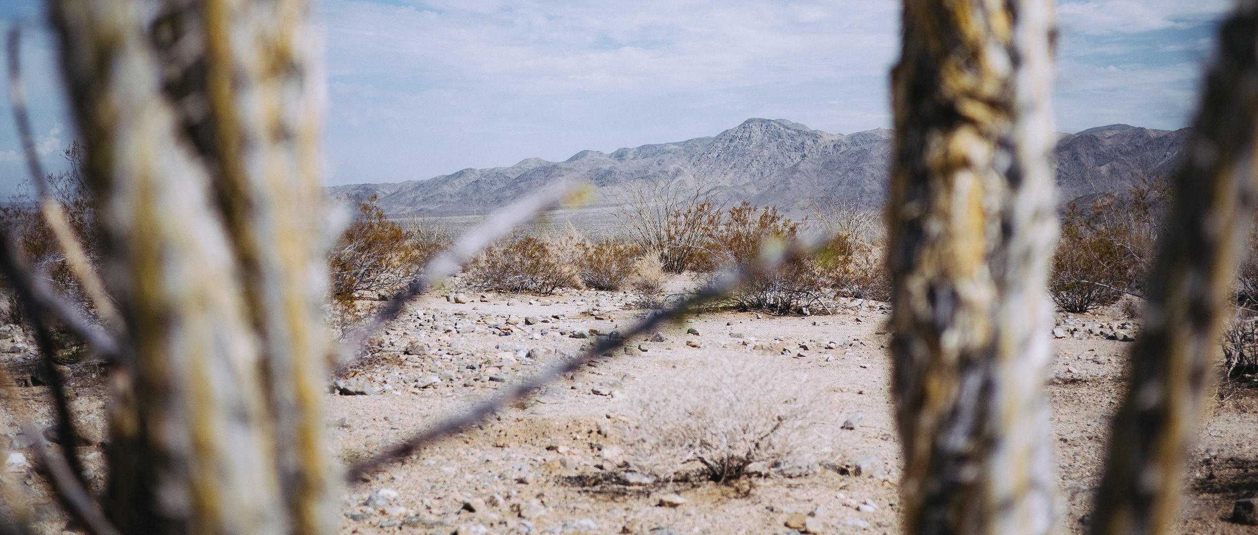
Much fewer bees here than at the Cholla Cactus Garden! But not much moisture either. We're in the Pinto Basin, which lies within the (lower and dryer) Colorado Desert - no Joshua tree to be found there.
It’s not entirely clear whether there’s more joy in the view, the destination or the drive up and down the winding roads of the North Coast of Trinidad.
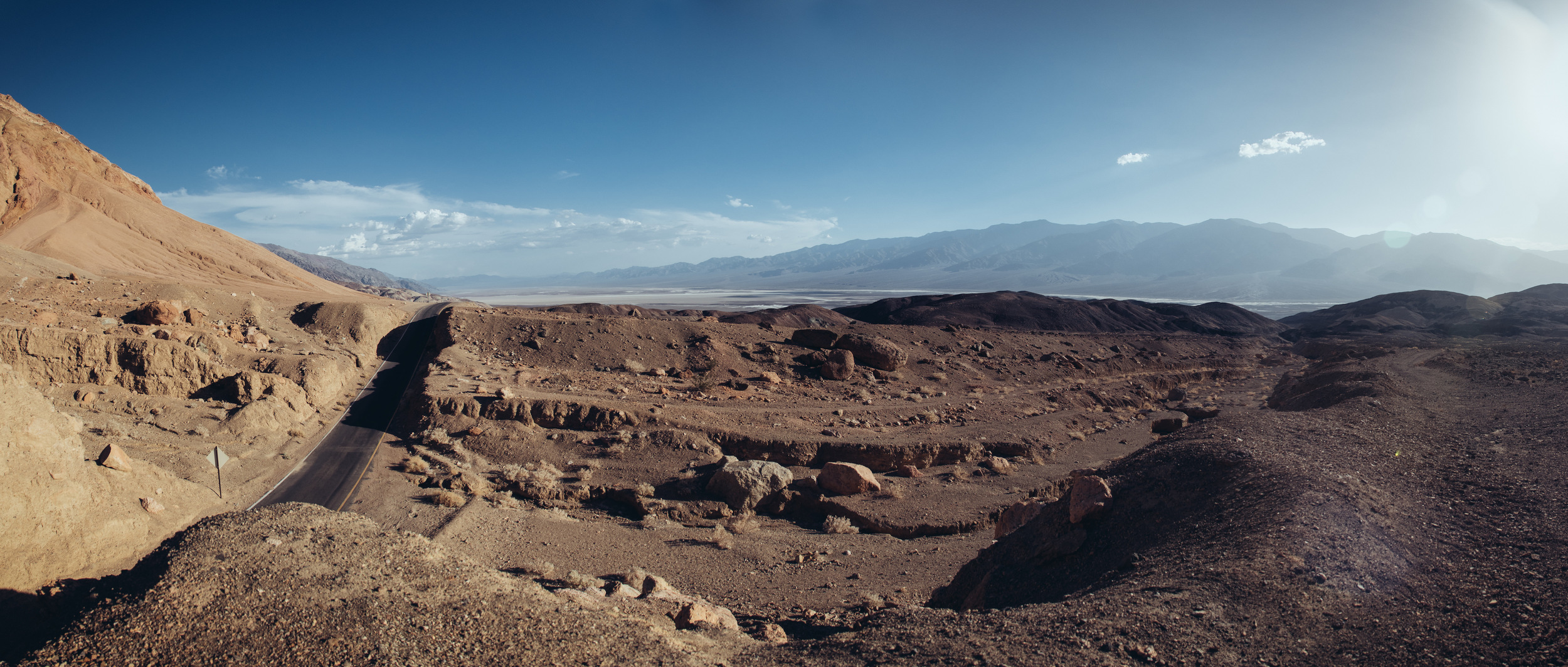
While the Death Valley National Park encompasses a large area, the actual "Death Valley: the driest place in North America” area is the valley between the Panamint and the Amargosa mountain ranges. The white-covered land in the distance is the Badwater Basin, which until ~10,000 years ago (the end of the Pleistocene ice age) was the floor of a freshwater lake called Lake Manly. After the ice age ended, the climate warmed up and Lake Manly dried up, leaving behind the area we now call Death Valley. That would explain why the floor of the Valley is 86m below sea level - 10,000 year ago there was 180m of water above where we’re standing.
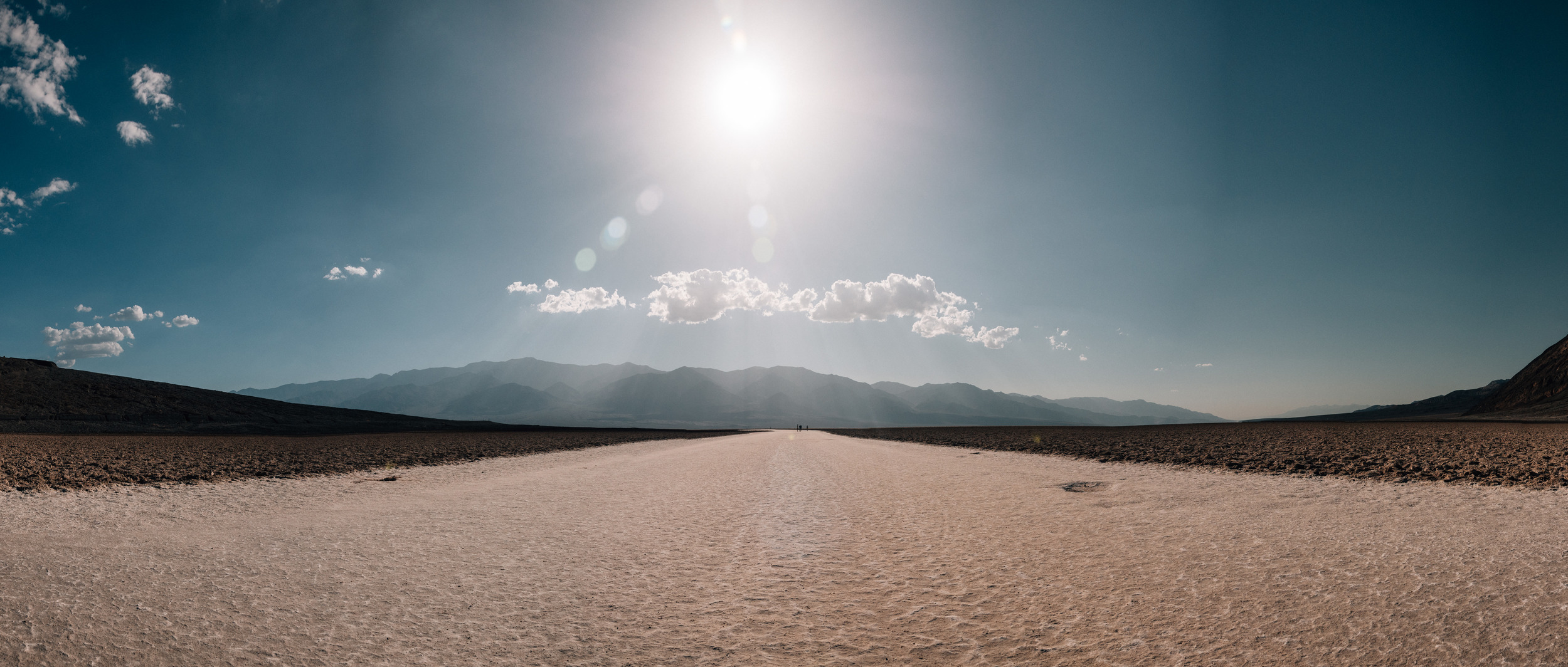
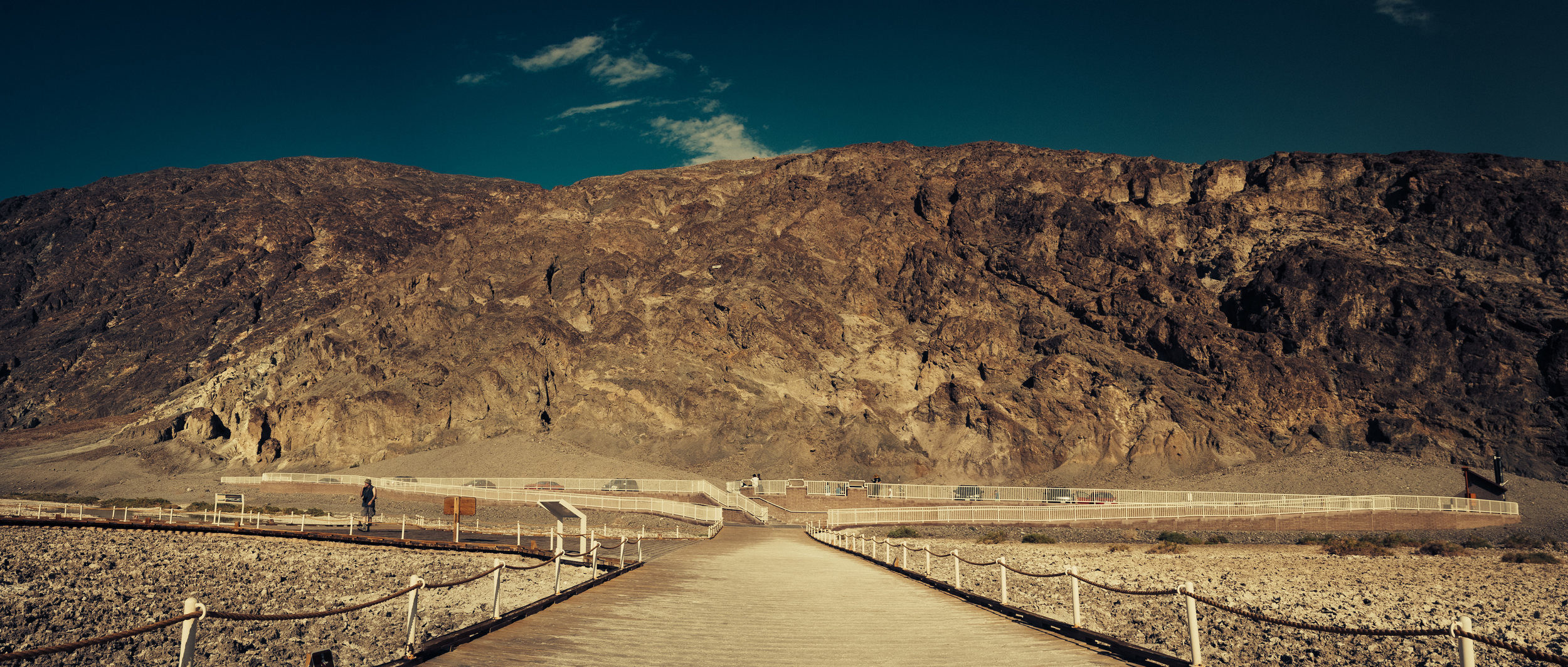
The driest place in as well as the lowest point in North America. If you take a piece of glass and exhale onto it, by the time you move it away from your mouth to look at it, it’s going to be fully dry. You can walk on these salt flats down the middle of the path, but going off this path is hazardous - often it’s just a thin layer of white crust over mud (plus the crust is sharp and edgy). Cause the ground is white, the sun is getting at you from all directions - you can get a heat stroke in just a few minutes. Not to say that you can’t be safe - just that it can get significantly unsafe for your health very, very fast. The day we were there the temperature was 50ºC (123ºF) in the valley.
Looks like a cactus, but turns out, it’s not a true cactus. When it rains, Ocotillo quickly gets covered with small leaves.
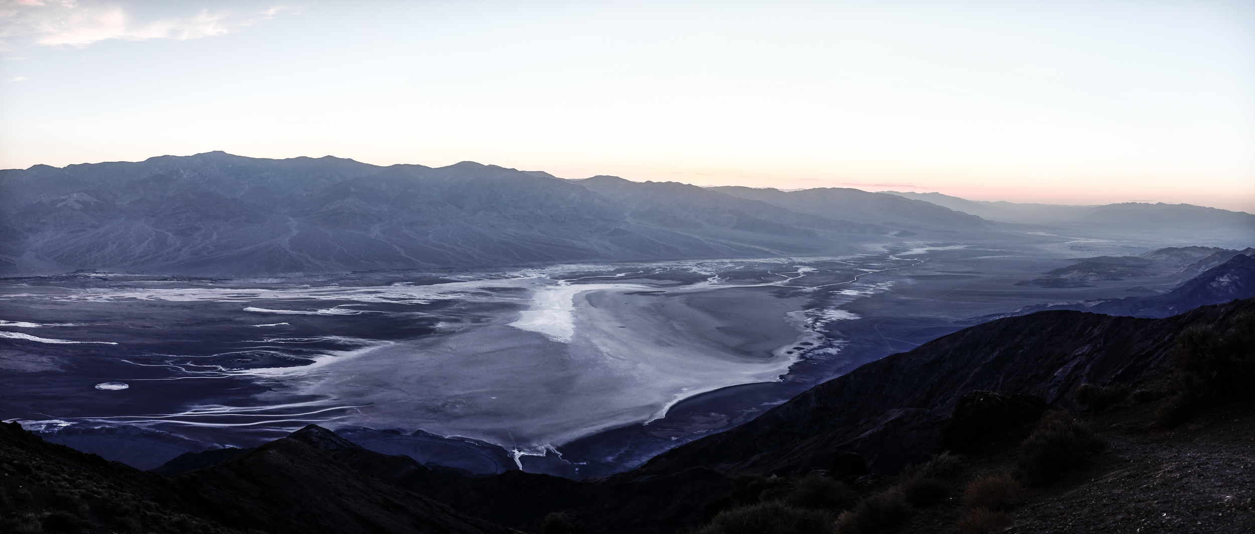
We’re at Dante’s View - a peak on Amargosa Range that is 1,669m above sea level. Compared to yesterday’s view from the floor of Death Valley (86m BELOW sea level) this is a 1,755m difference in elevation. The two areas are separated by mere 3.8km, but due to the dramatic change in elevation, you have to do a 60km detour in order to get from Badwater Basin to Dante’s View. Today, you’re looking at the driest place in North America, but mere 10,000 years ago you would have been looking at a freshwater lake that would have spanned from the sunray-blocking Panamint Range in the background to base of the downward mountain slope we're standing on.
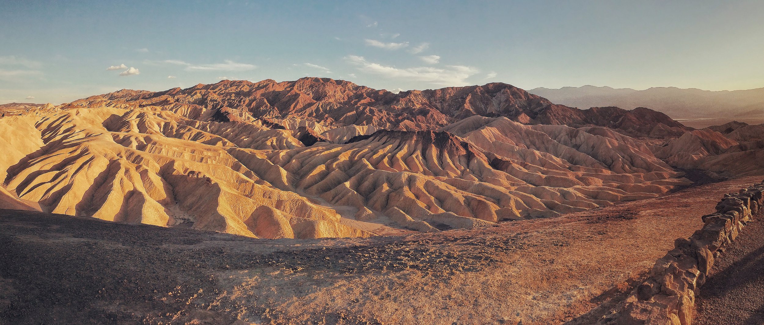
This landscape is composed of sediments from Furnace Creek Lake, which dried up 5 million years ago. The cover of U2’s “The Joshua Tree”, despite the name of the album, features the view of THESE exact Badlands from Zabriskie Point. The biggest misconception about the tree on the cover of The Joshua Tree is that it lies within the eponymous Joshua Tree National Park, which is a four-hour drive to the south from U2’s tree. The tree used to be located in the Mojave Desert, a stone throw south of the CA-190 highway between Panamint Springs and Olancha. Unfortunately, U2’s tree fell down in October of 2000, but it’s still lying there, in situ.
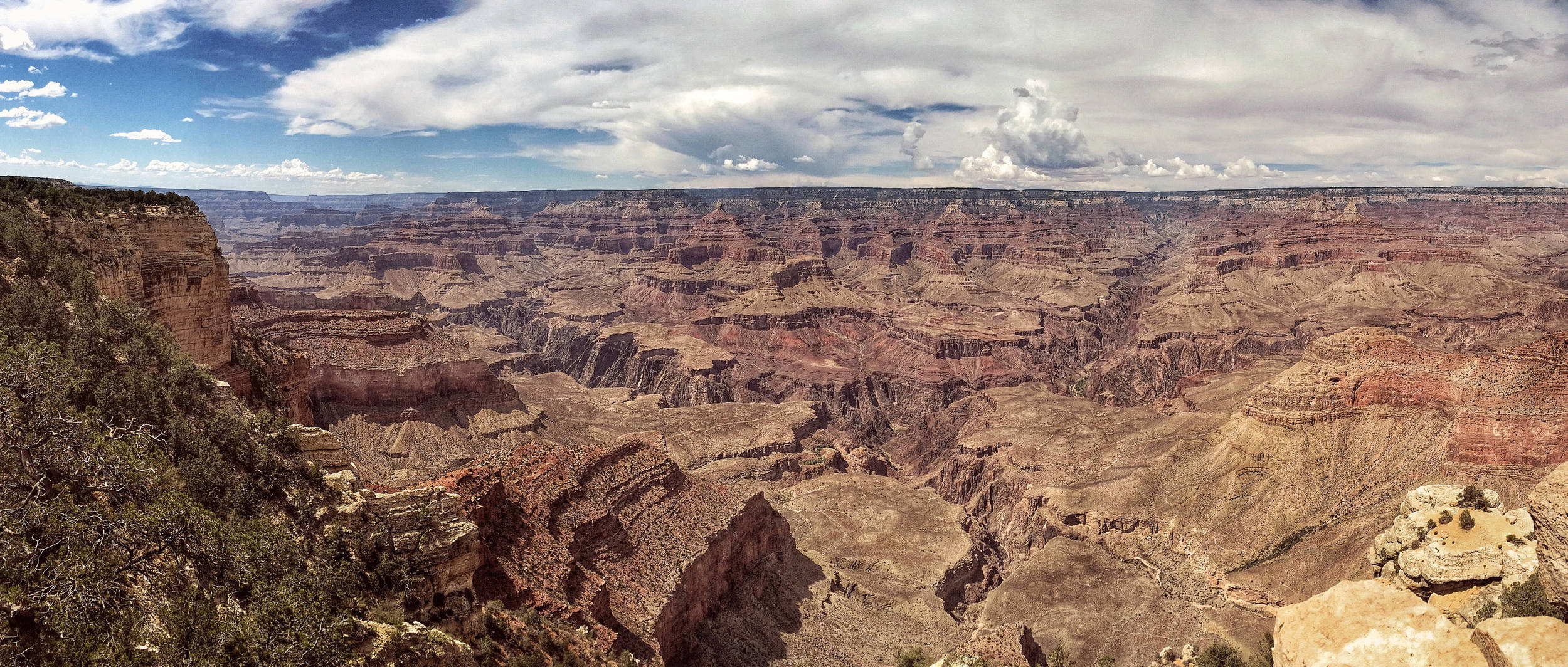
The first time we drove thru the Grand Canyon National Park was at night, it was a cloudy night and we couldn’t see any of the Canyon. Total darkness; pitch black. As we drove along the South Rim, on one side of the road there's a forest and total darkness there; the other side felt like the home of nothingness. And that nothingness stretched for miles and miles. No lights, no shapes, no sounds. Completely spooky. The initial thought was that maybe the road is very far away from the Canyon itself and that’s why we can’t see anything. But then the following day, as we drove down the same road, it was clear that the road comes as close as 20 meters away from the rim. You can drive off the road and into the Canyon without ever realizing how far down you’re going to fall. The Void is strong at Grand Canyon. And it’s mesmerizing.
Hesperides were the nymphs of the evening and the golden light of sunset, the "Daughters of the Evening" or "Nymphs of the West”. They tended a beautiful garden at the far western corner of the world near the Atlas Mountains of Morocco.
Currently standing 86m below sea level, albeit mere 10,000-12,000 years ago there would have been 180m of water above our heads. Dante's View is just a bit to our right, only much much higher up - 1669m above sea level.
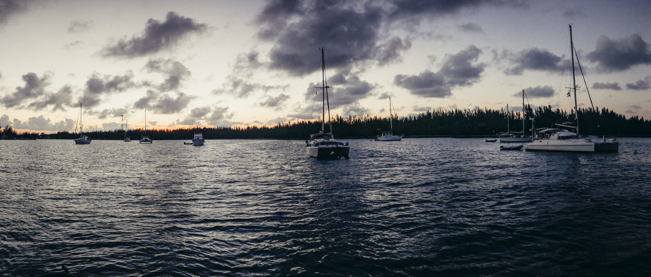
There’s a highway running from Marsh Harbour to Treasure Cay, so anyone can travel to it by car. But the preferred method for pleasure-seekers is to go by boat, especially as Brigantine Bay provides cover from the waters of the Abaco Sea.
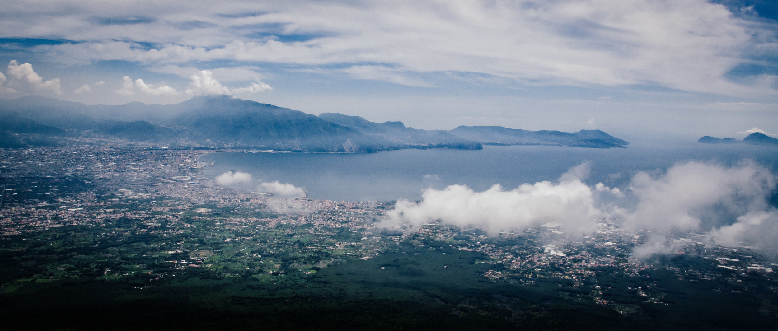
The slopes of Vesuvius gradually come down from up-above-the-clouds to sea level. The island of Capri is across the bay, with Pompei and Sorrento lining the shores of the Bay of Naples. Vesuvius has done its fair share of explosions over the years, but it's not even what's dangerous about the Bay of Naples. The true giant here is Campi Flegrei - a massive supervolcano whose caldera IS the Bay of Naples itself. Lying mostly underwater, the area of the caldera comprises 24 craters and volcanic edifices. The second most-recent explosion here - Campanian Ignimbrite eruption - happened ~37,000 years ago and extruded at the very least 150 km3 of magma. ONE HUNDRED FIFTY cubic kilometres of material! Take 150 km and extrude that in 3 dimensions - that is enormous! We don't really think about supervolcanos like Campi Flegrei very often because the time frame of their eruptions is longer than historical records - the Campanian Ignimbrite eruption took place when Homo sapiens and Neanderthals co-existed in Europe; the most recent eruption happened 12,000 years ago. There is some research, albeit not universally agreed upon, that supports the hypothesis that Campanian Ignimbrite eruptions drove Neanderthals to extinction and cleared the way for modern humans to thrive in Europe and Asia.